Telecoms · Horizontal directional drilling
Communication Duct Installation Under the M1, Junction 15, Northampton
- Location
- M1 Junction 15, Northampton
- Works carried out
- June 2022
- Published
- Written by
- Darren York, Director
Key takeaways
Winvic and MSF Mason Street Furniture needed communications ducting under two live slip roads at Junction 15 of the M1. EPS installed four 125mm HDPE purple ducts by horizontal directional drilling — two 50-metre bores at each location, one duct in each, across two eight-hour night possessions. The slip road surfaces were never broken, and both roads were handed back on time with no reinstatement outstanding.
Project at a glance
| Client | MSF Mason Street Furniture (contracting client) · Winvic / Segro (principal contractor and developer) |
|---|---|
| Scheme | M1 Junction 15 highway improvements for the Northampton Gateway Rail Freight Interchange (Segro Logistics Park Northampton Gateway) — a Development Consent Order scheme |
| Designer | BWB Consulting Ltd (ducting layout, Works 11, drawings NGW-BWB-HDG-HW30/HW31-DR-CH-0570). Ground investigation by Hydrock Consultants Ltd. |
| Location | M1 Junction 15, Northampton |
| Project date | June 2022 |
| Method | Horizontal directional drilling |
| Product installed | 125mm HDPE purple duct — four in all, one per bore, two bores at each of two slip road locations |
| Bore length | 4 × 50m shots (200m total) — two 50-metre bores at each slip road location |
| Ream diameter | 160mm — the 125mm duct went into a bore opened out to roughly 1.3 times its diameter, enough clearance to pull without dragging the duct through an interference fit |
| Obstacle crossed | Two live M1 slip roads |
| Ground conditions | Glacial till (Oadby Member) and glaciofluvial deposits over Whitby Mudstone Formation. Crew logged clay throughout; no obstructions encountered. |
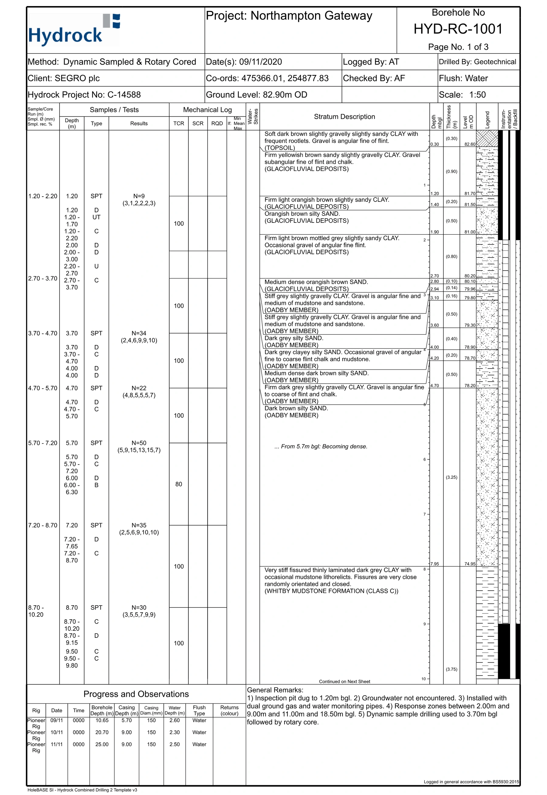
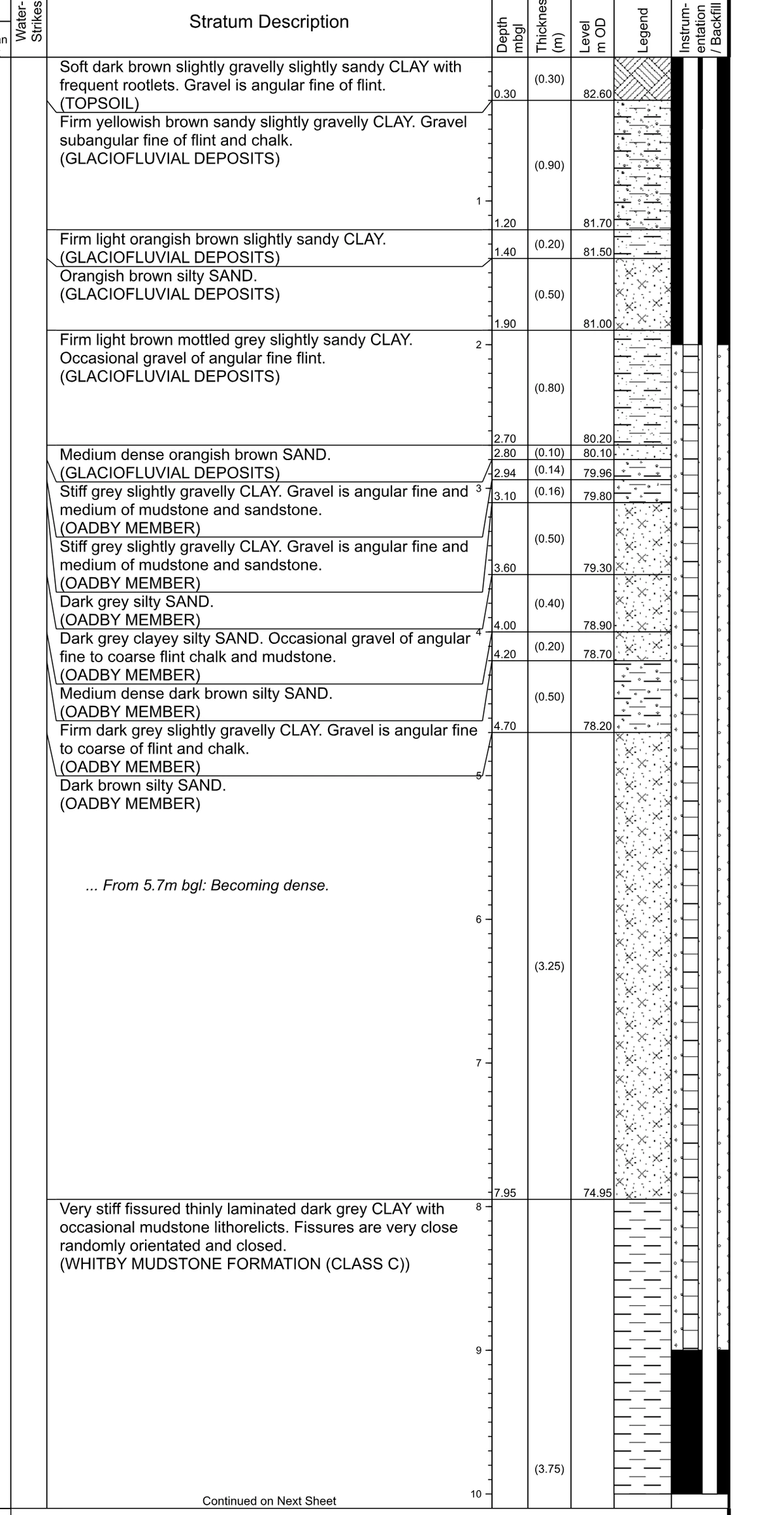
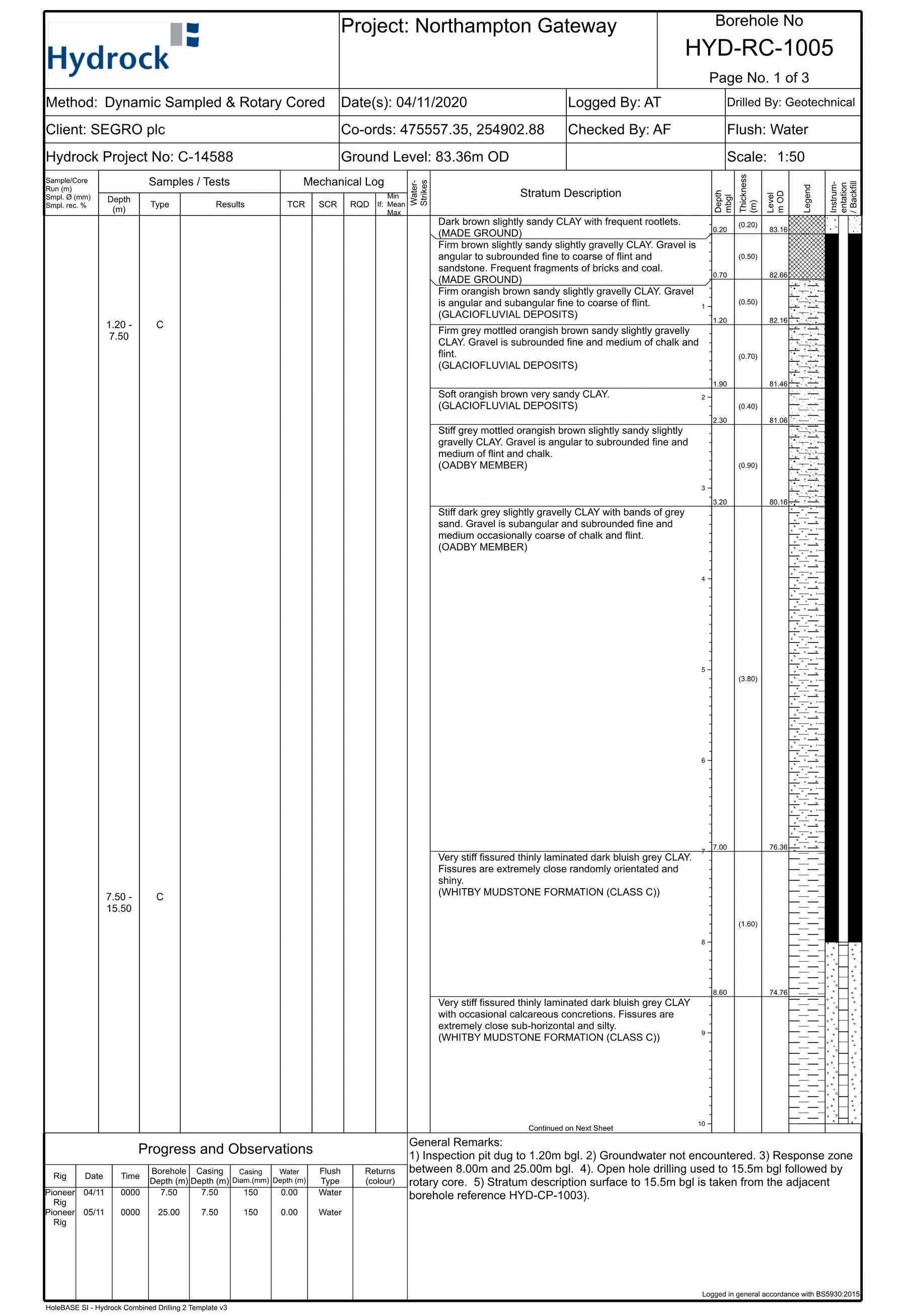
| Ground investigation | Hydrock Consultants Ltd, Factual Ground Investigation Report for SEGRO, DCO Workstage 8 (NGW-HYD-SGT-SM2-RP-GE-1024A, S2/P01, 8 January 2021). Boreholes HYD-RC-1001, 1002 and 1002a were sunk for the northbound on-slip and service crossing; HYD-RC-1005 and 1006 for deep elements including the service crossing. |
| Rig | Ditch Witch JT3020 |
| Survey | GPR utility data and drill profile produced by Winvic and their designers; EPS drilled to that design |
| Verification | Bore log taken with a Subsite Marksman locator — depth and pitch captured at every rod, giving an as-built profile of each bore to set against the approved design. Independent road monitoring across both crossings recorded no measurable movement. |
| Bore log software | Subsite TMS Plus — the bore plan and the logged rod-by-rod data are held in the same software, which produces the completed survey and as-built map handed over at the end of the job |
| Standard | CD 622 Managing Geotechnical Risk, Revision 1 (March 2020) — the version current at the time of these June 2022 works. Absorbed HA 120/08, the former standard for trenchless installation of services beneath motorways and trunk roads |
| Constraints | Night possessions only, live motorway environment, existing services in the verge and central reservation |
| EPS scope | Drilling and duct installation. Design, GPR survey, pit excavation and reinstatement, traffic management (a specialist subcontractor) and road monitoring were carried out by others. |
| Duration | 2 × 8-hour night possessions, one for each crossing — 9pm to 3am on the road, plus an hour either side for set-up and clearance — in June 2022 |
Who we worked for
MSF Mason Street Furniture is a Northamptonshire highways contractor. They work across street lighting, traffic signs, EV charging and civil engineering, and operate as an Independent Connections Provider. MSF engaged EPS for the two slip road crossings. Winvic, one of the UK’s largest industrial and logistics contractors, was delivering the wider scheme for Segro.
Both needed the same thing: communications duct across two live M1 slip roads, without opening the carriageway. Excavating a motorway slip road means full closure, diversion routes and reinstatement to National Highways specification — on one of the busiest stretches of motorway in the Midlands. EPS came in as the duct installation contractors for the two crossings where that could be avoided.
What made this crossing difficult
Two things made this job difficult, and both came down to time.
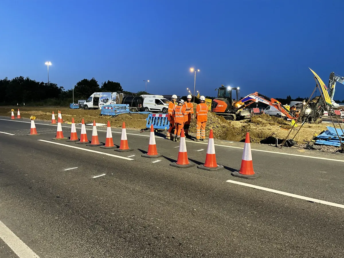
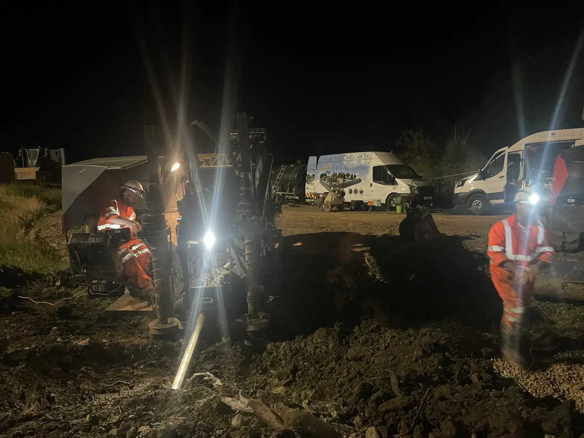
The working window. Each possession ran eight hours, but only six of those were on the road: nine at night until three in the morning, with an hour either side for getting set up and getting clear. Six hours to launch, drill a 50-metre bore, ream it, pull the duct through and clear the site. There is no overrunning on a motorway slip road. The possession ends when it ends, and if the bore is not finished the site is made safe and the road handed back regardless.
Everyone else. Ours was not the only work happening at Junction 15 on those nights. Several contractors were operating in and around the same area, sharing access and working space inside the same narrow window — so the programme had to be coordinated around other crews before a single metre could be drilled.
On top of the clock: a live motorway environment with the safety regime that comes with it, existing services in the verge and central reservation, and duct that had to arrive on line and at depth first time, because there was no opportunity for a second attempt.
How we did it
Drilling to a design, not to a plan of our own
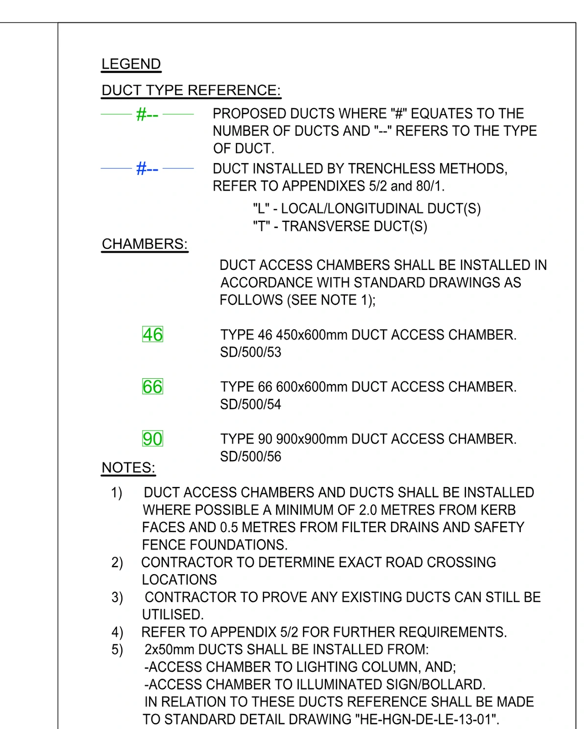
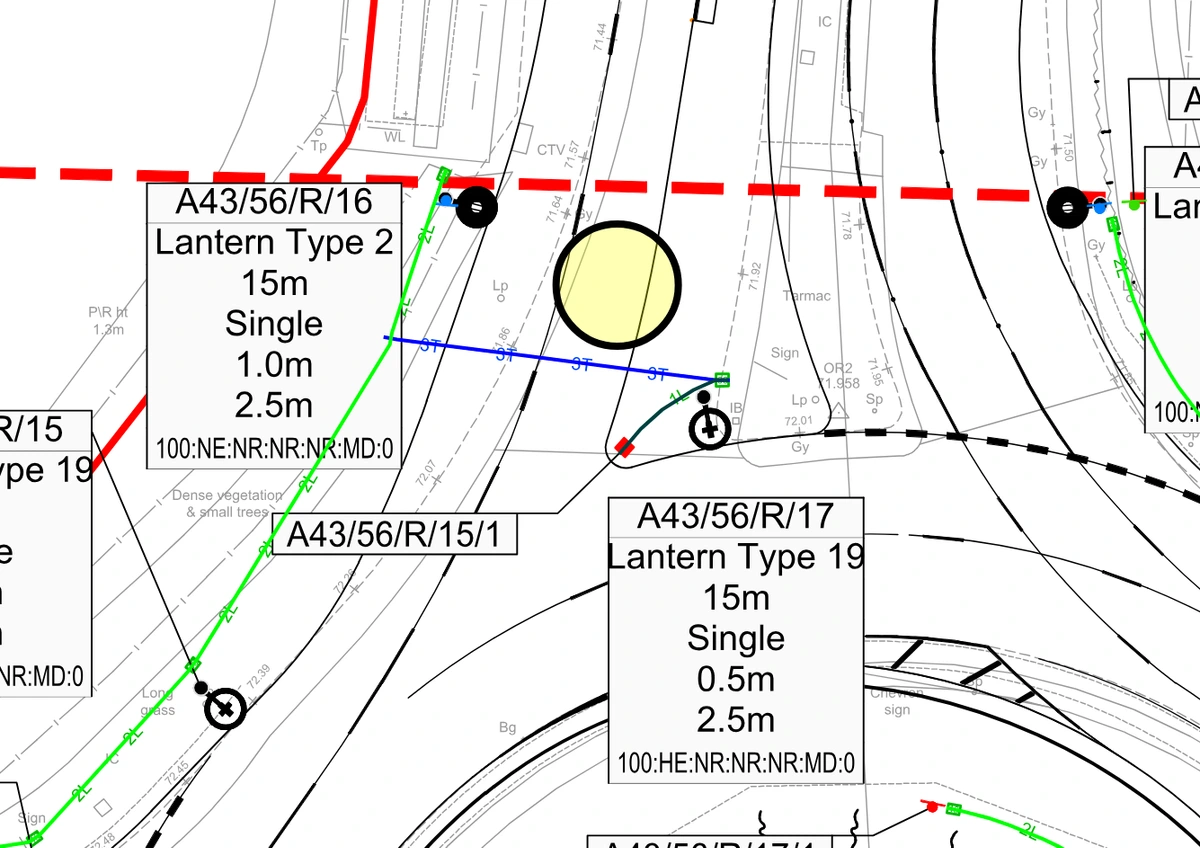
On a crossing beneath the strategic road network, the bore profile is not the driller’s to invent. Winvic and their designers produced the GPR utility data and the drill profile, and carried the geotechnical design duty that sits with the designer under CD 622. The ducting layout was designed by BWB Consulting as part of Works 11, with the drawings specifying which ducts were to be installed by trenchless methods.
One thing the design deliberately left to the contractor was the exact crossing location. That is not a loose end. It is the point at which drilling experience has to meet the drawing. EPS confirmed the setback each rig needed and checked the profile would work from the positions available, before anything was committed to. Getting that wrong is discovered at two in the morning, with no room to move the rig and no possession left. EPS was engaged to execute that design and to prove it had been executed.
That distinction matters more than it sounds. A contractor who improvises a bore path beneath a motorway has nothing to submit afterwards. A contractor who drills to an approved profile, and logs it, has a record that stands up.
What CD 622 requires
CD 622 Managing Geotechnical Risk is the National Highways standard governing geotechnical risk on the strategic road network. It absorbed HA 120/08, the former standard covering trenchless installation of services beneath motorways and trunk roads, so a duct crossing under an M1 slip road falls squarely inside it. These works were carried out to Revision 1, dated March 2020, which was the version in force at the time. A further version was published in September 2025 — anyone planning a crossing now should check which revision applies to their scheme.
In practice a crossing is not simply approved and drilled. The design carries defined geotechnical duties, the works are documented against that design, and the record is what demonstrates the highway asset was not put at risk. All of it happens before the possession. None of it can be resolved on the night.
Drilling and pull-back
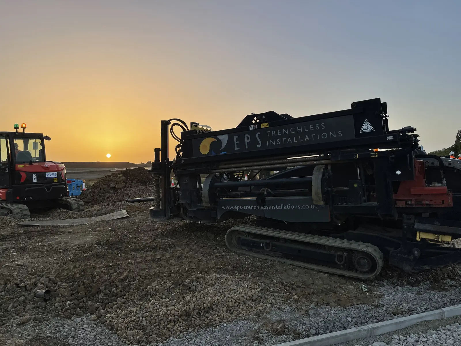
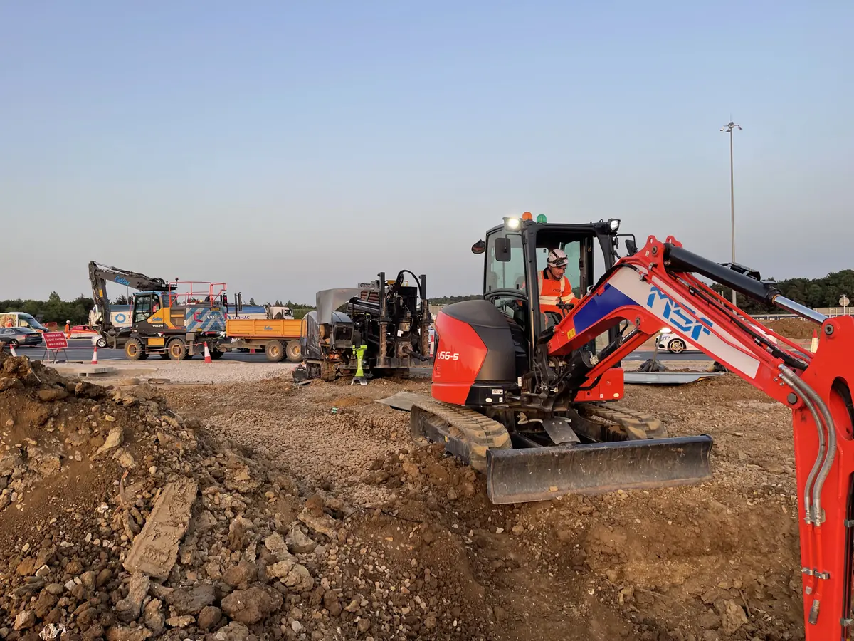
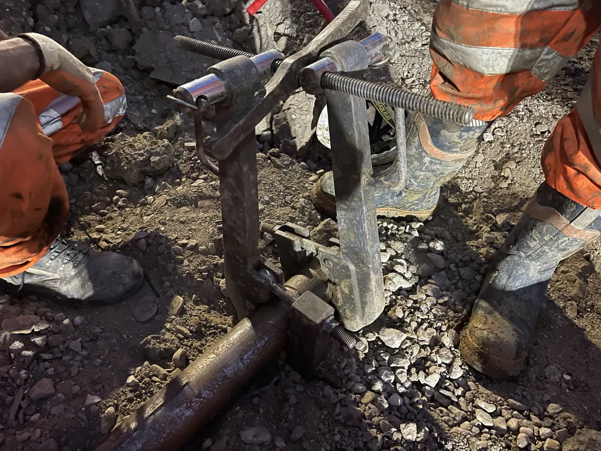
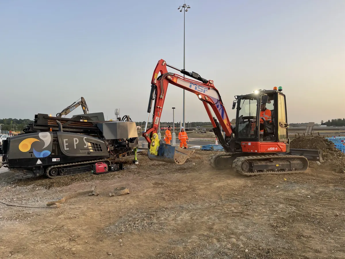
Both crossings were drilled with a Ditch Witch JT3020. Each location took two 50-metre shots, side by side, from pits sited outside the running lanes — four bores in all, each one pilot-drilled, reamed out to 160mm and pulled back with a single 125mm duct inside the same possession.
That is one duct per bore, not two ducts sharing one. The two are not interchangeable: a pair of 125mm ducts bundled together sits inside an envelope around 250mm across, so sharing a bore means reaming to roughly twice the area rather than pulling a second 160mm shot beside the first.
Two separate locations meant the whole sequence — set-up, pilot bore, ream, pull-back, make safe — run from scratch at the second. Nothing carried over from the first except what the crew had learned.
How do you prove a bore was drilled to the approved design?
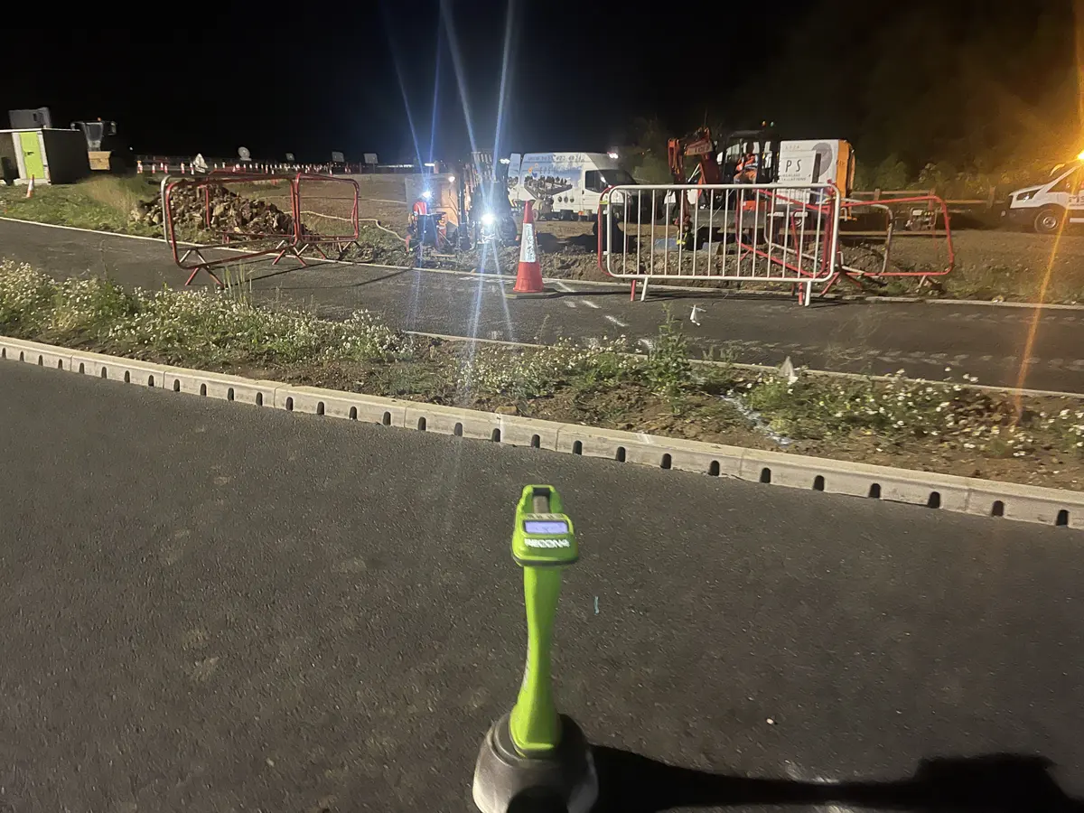
Every bore was logged as it was drilled. On this job that was a Subsite Marksman locator — the same manufacturer as the rig, both Ditch Witch. The locator guiding the head also reads depth and pitch at every rod, so the as-built profile is built up while the bore advances rather than reconstructed afterwards.
That log is the evidence. It shows the bore that was drilled against the bore that was designed, and it is finished by the time the crew leaves site. Where the design duty sits with the client’s designers, handing back a verified as-built is what closes the loop.
Road monitoring was set up independently by others across both crossings. All readings came back within tolerance — no measurable movement in the carriageway above any of the four bores.
What ground conditions are found at M1 Junction 15?
The ground here is documented properly, which is not always the case on a highway crossing. A factual ground investigation report was produced by Hydrock Consultants for Segro under DCO Workstage 8, and three of its rotary-cored boreholes — HYD-RC-1001, 1002 and 1002a — were sunk specifically for the northbound on-slip and service crossing. Two more, HYD-RC-1005 and 1006, targeted deep elements including the service crossing. That is site-specific data at the crossings themselves, not a map extrapolation.
Borehole 1002 has a footnote worth repeating, because it says something about how tightly this scheme was controlled: it was abandoned at 6.80 metres when a badger sett was found nearby, backfilled with bentonite pellets, and redrilled as 1002a only after ecologists had relocated the badgers. That is why there are two logs at almost the same coordinates.
The sequence beneath M1 Junction 15 runs:
| Stratum | Depth to top (m bgl) | Thickness (m) |
|---|---|---|
| Topsoil / Made Ground | 0.00 | 0.16 to >1.20 |
| Glaciofluvial Deposits | 0.16 – 0.70 | 1.00 – 14.10 (avg 3.96) |
| Oadby Member (Glacial Till) | 0.60 – 6.70 | 2.20 – 13.60 (avg 6.21) |
| Whitby Mudstone Formation | 7.00 – 17.60 | Not proven |
Both are BGS-recognised units, and the sequence is what the regional mapping would predict for this part of Northamptonshire: Anglian-age glacial till and glaciofluvial outwash over Lower Jurassic Lias Group mudstone.
What that means for a bore. A crossing at highway depth sits in the superficial deposits — glacial till, glaciofluvial material, or the boundary between them — rather than in bedrock. The Oadby Member is recorded as firm to stiff slightly sandy, slightly gravelly clay, which is cohesive, holds a bore open and steers predictably. That is the ground a driller wants.
The risks sit in the detail. The till carries sand lenses and occasional cobbles, with gravel of flint, chalk and sandstone — cobbles being the classic cause of steering deflection and a compromised bore. Selenite crystals up to coarse gravel size were logged from around 2 to 3 metres, occasionally with cobble-sized gypsum. And the glaciofluvial deposits come in two forms: a fine, clay-dominated material that behaves much like the till, and a coarse sand-and-gravel variant that does not — running sand and loss of circulation are live risks where a bore clips it. Groundwater in the Oadby Member was recorded between 3.90m and 15.50m below ground level, though the report notes water flush in the rotary-cored holes masked groundwater during drilling, so those figures are a guide rather than a water table.
What we encountered. The crew logged clay throughout, consistent with the till and the fine glaciofluvial material rather than the coarse variant. No obstruction was met on either crossing — which matches the investigation, where no significant obstructions were recorded either. The ground behaved as the report said it would, and on a six-hour possession with no second attempt available, that is the difference between a routine night and a very long one.
What went wrong
Nothing did — and that is worth saying plainly rather than dressing up.
All four bores were drilled, reamed, pulled and cleared with time in hand, two to a possession. Neither possession ran over. No obstruction was met. The monitoring came back in tolerance. On a live motorway slip road, that is the outcome everyone wants and nobody should assume.
It was not luck. The ground had been properly investigated, with boreholes sunk at the crossing locations themselves rather than nearby. The profile was designed and approved before anyone booked a possession. The rig setback was checked against the positions actually available, so the crew were not solving a geometry problem in the dark. And the bore was logged as it was drilled, so the evidence was complete before the site was handed back.
The work that keeps a six-hour possession comfortable happens weeks earlier. When a motorway crossing overruns, the cause is almost never the drilling.
Handback
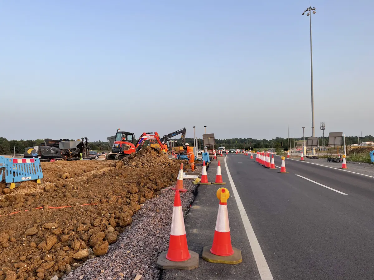
The pits sat clear of the running surface, and pit excavation and reinstatement were carried out by others. EPS’s part was the bore: drilled, logged and complete inside the window, so nothing held up the handback. Off the road by three, as agreed.
Why directional drilling rather than open-cut
| Open-cut trench | Directional drilling | |
|---|---|---|
| Slip road surface | Excavated across full width | Never broken |
| Possession required | Extended, likely multiple nights or full closure per location | One night possession per location — six hours on the road |
| Diversion routes | Required | Not required |
| Carriageway reinstatement | Full National Highways specification | None — no carriageway was opened |
| Verification | Reinstatement inspected after the fact | As-built logged during the bore; monitoring confirmed no movement |
| Handback risk | Trench open at shift end | Site safe at shift end |
| Disruption to motorway traffic | Significant | None to the running carriageway |
On a motorway slip road, the deciding factor is not cost per metre. It is whether the road can be handed back when the possession ends.
That is why this was directional drilling work. The length suited it, the accuracy demanded it, and there was no second attempt available.
The outcome
Both crossings were completed inside their possession windows, on two separate nights. That was the constraint governing everything about this job, and it was met twice.
All four 125mm ducts went in on line and at depth, drilled to the approved profile and logged as they went. The carriageway was never opened. Independent monitoring recorded no movement above any of the bores.
When we would recommend a different method
Auger boring instead of HDD
Where rock or hard strata make a steerable bore impractical, where a steel casing is specified, or where settlement tolerance beneath a structure is critical.
Auger boringMoling instead of HDD
For short branches and small-diameter services — a domestic supply, a lighting column feed, a spur off a main run. Faster and more economical where the distance is short and steering is not needed.
MolingThis crossing was directional drilling work on all three counts: fifty metres under a live carriageway, an approved profile to hold to, and a possession that left no second attempt. Shorter runs, or ground too hard to steer through, and we would have pointed you at one of the methods above instead.
The crossings under the slip roads were the part of the works with the least room for error — a fixed possession, a live motorway, and no second attempt. EPS drilled to the approved profile on both nights, logged the bores as they went, and were off the road on time. The monitoring came back in tolerance. It was a straightforward piece of work because they made it one.
On site
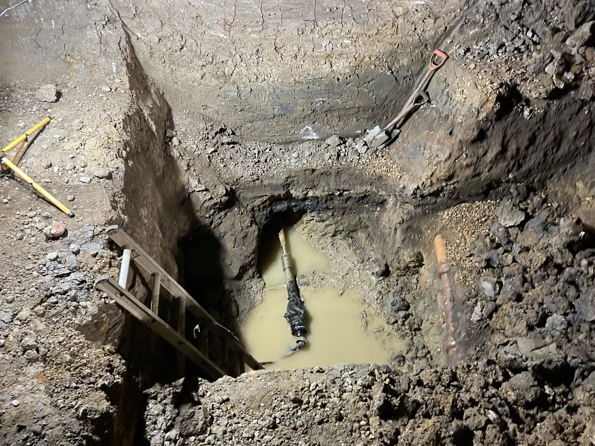
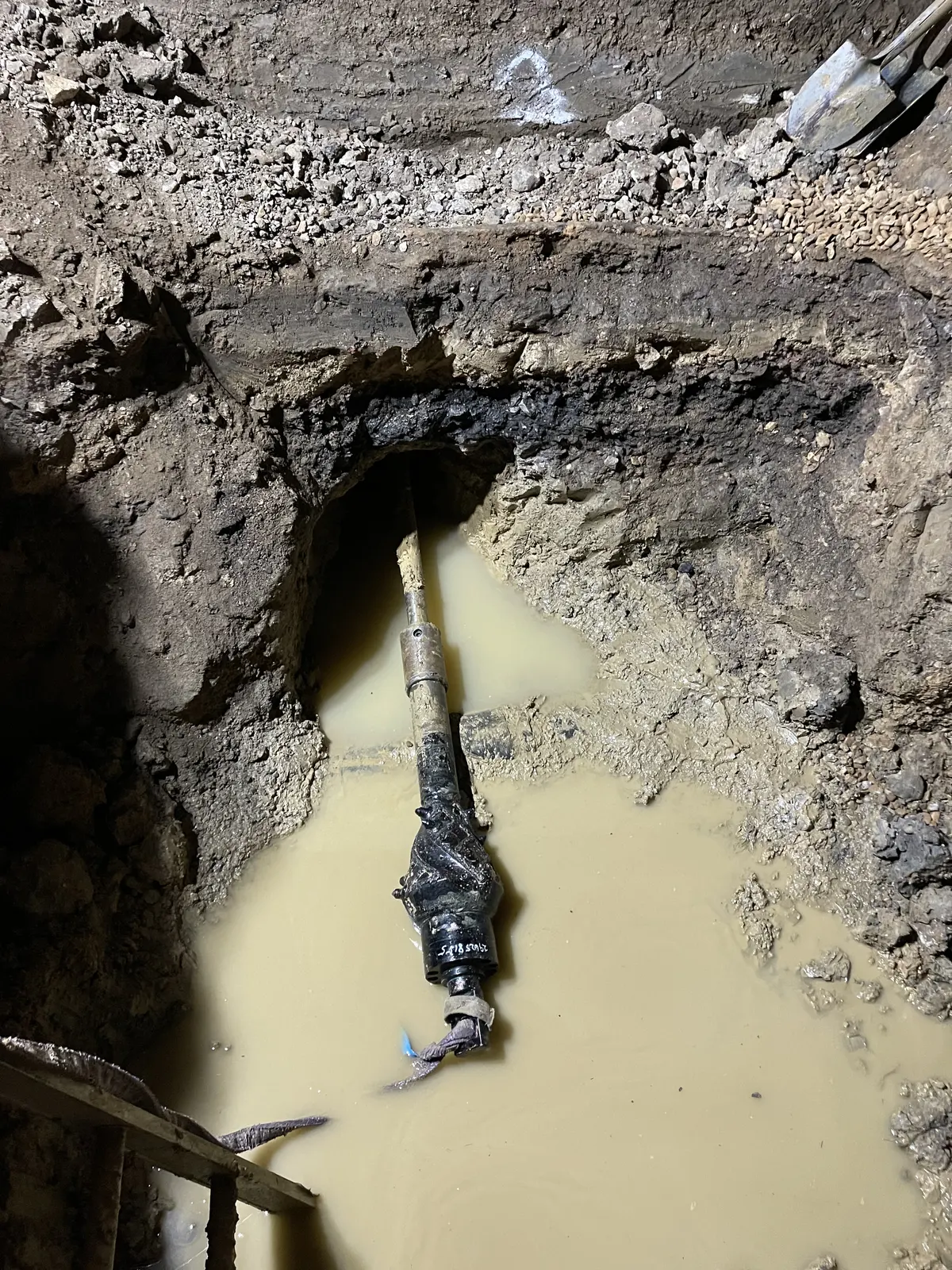
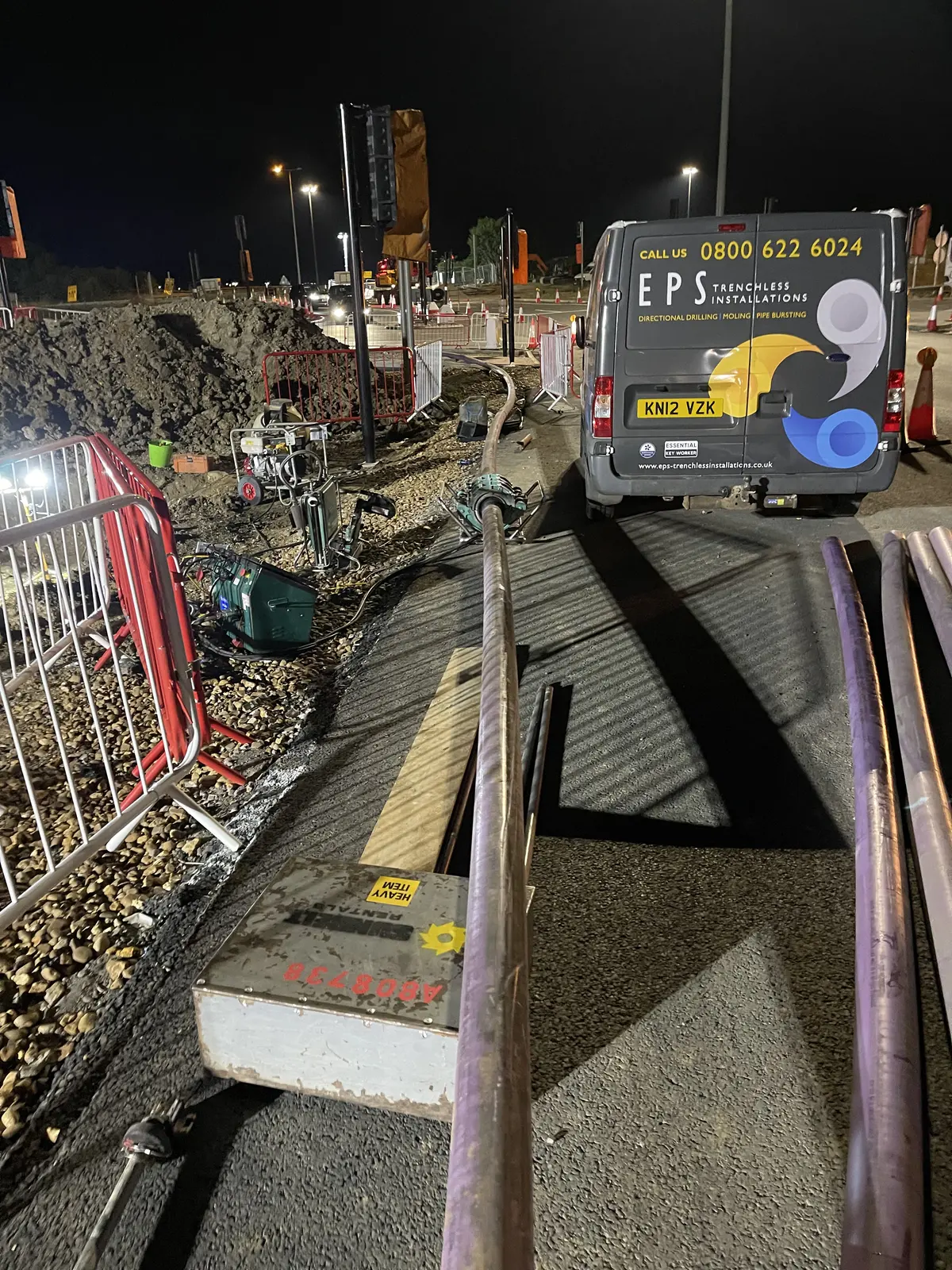
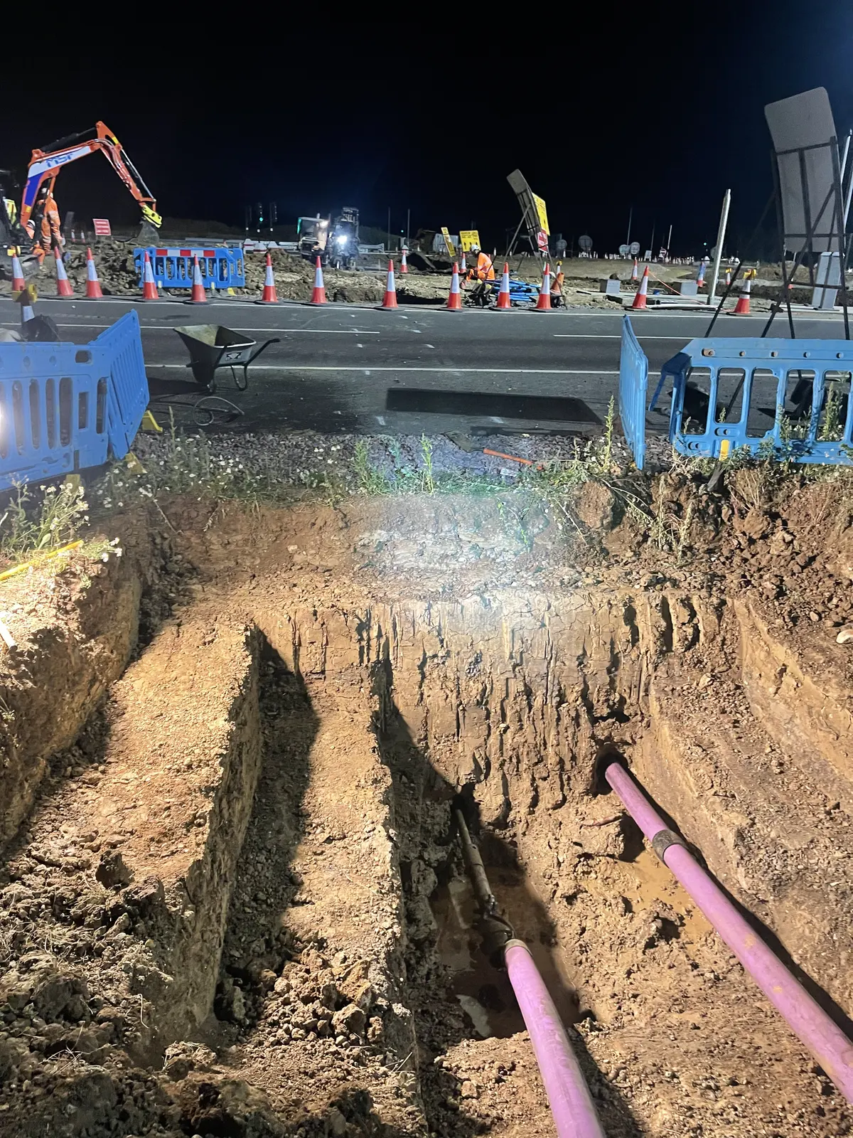
The design and the ground investigation
Site footage
The JT3020 being tracked across the carriageway to the far pit, traffic held at temporary lights, with the coned buffer and the new kerbline visible either side.
What this clip shows
Twelve seconds, silent. The rig is driven under its own power across the carriageway rather than lifted, so the sequence shows how a crossing is set up without breaking the road surface.
An EPS operative in orange hi-vis and a white hard hat walks alongside the JT3020, controlling it on a handset as it tracks off the verge and onto the carriageway. A red temporary traffic light holds a queue of vehicles, an articulated curtain-side lorry nearest the camera. Cones taper along the lane edge to the right. To the left is the excavated verge and the newly laid kerbline; the sun is low behind the treeline.
What the locator shows the operator
Filmed on another EPS bore rather than at Junction 15 — a receiver screen is far easier to film in daylight than in a coned lane at one in the morning. The numbers on it belong to that bore. It is here because it shows the part of the work no still photograph can: an operator stood over the drill head, reading what the beacon underneath him is sending up, and being told which way to move.
A hand-held receiver picking up the beacon in the drill head — signal, pitch, roll and distance, with an arrow telling the operator which way to walk.
What this clip shows
Eight seconds, silent, filmed close in on a hand-held locator receiver stood upright on grass with a yellow cable looping past it.
Down the left of the screen: signal strength of 100, a pitch of -23.0% in red, and battery at 90%. In the centre a twelve-position dial gives the roll of the drill head — which way its steering face is pointing. Down the right are three distances in centimetres, the lowest of them picked out in red. A green arrow at the top of the screen points left, and 46k at the foot is the frequency the beacon is transmitting on.
The pitch and the roll hold steady for the whole clip; two of the three distances move, one falling from 370 to 351 cm and one rising from 74 to 79 cm. Nothing is being drilled in these eight seconds — it is the operator walking the receiver in on the head, with the arrow telling him which way to go to get over it. Standing there is what makes the reading possible, and it is those readings, taken rod by rod, that become the as-built profile of the bore.
Frequently asked questions
How much does a motorway duct crossing cost?
No two crossings price the same. The cost is set less by the metres drilled than by everything around them: the survey and approvals before anyone reaches site, the possession and traffic management, and the bore length and depth the road demands. Junction 15 was two 50-metre shots at separate locations. Each needed its own pits, possession and set-up — two crossings, priced as two crossings. The dependable way to price a job is a feasibility review of the actual site.
What is CD 622 and does it apply to my scheme?
CD 622 Managing Geotechnical Risk is the National Highways standard for managing geotechnical risk on the strategic road network. It replaced HA 120/08, the former guidance on trenchless installation of services beneath motorways and trunk roads, so if you are crossing under a motorway or trunk road it applies. It sets out the geotechnical duties, documentation and certification a scheme has to produce — obligations sitting largely with the designer, while the drilling contractor's job is to install to the approved profile and evidence that they did. Check which revision applies to your scheme — Revision 1 dated March 2020 governed works at the time of this project, and a further version followed in September 2025.
How do you prove the bore was drilled to the approved design, and what guidance system does EPS use?
By logging the bore as it is drilled. The locator guiding the drill head also reads depth and pitch at every rod, recorded while the bore advances rather than reconstructed afterwards, so the as-built profile is finished before the crew leaves site and can be set straight against the designed one. Junction 15 was drilled in June 2022 with a Subsite Marksman — the same manufacturer as the JT3020 rig, both Ditch Witch — and logged on that system. EPS has since moved to the DigiTrak Falcon F5 with Log-While-Drilling (LWD), from Digital Control Incorporated, which records depth, pitch and drilling fluid pressure rod by rod through its DataLog function and turns it into an annotated profile and client report, geo-tagged at entry and exit. Newer equipment, same principle — and the principle is the part worth asking a contractor about. At Junction 15 independent road monitoring was also in place across both crossings, and all readings came back within tolerance.
Can a motorway crossing be completed in a single night possession?
It depends on length, ground, and how many services need locating first. At Junction 15 each 50-metre crossing was completed inside a single possession — eight hours, of which six were on the road, from 9pm to 3am. Two locations meant two possessions. The survey and approvals work has to be finished well before the night, not on it.
How do you avoid striking existing services in a motorway verge?
A GPR survey ahead of bore path design, cross-referenced against statutory records. Motorway verges carry lighting, signage, drainage and communications apparatus in close proximity, so positively locating them beforehand determines where the bore can safely run.
What ground conditions are found around Junction 15 of the M1?
Glacial till — the Oadby Member — and glaciofluvial deposits over Whitby Mudstone Formation bedrock, which is typical of this part of Northamptonshire. Site investigation for the scheme recorded the till as firm to stiff slightly sandy, slightly gravelly clay: good ground for directional drilling, since it holds a bore open and steers predictably. The things to watch are cobbles and sand lenses within the till, and the coarser sand-and-gravel glaciofluvial material, where bore stability and loss of circulation become real risks.
Who obtains the permissions for works in the highway?
It depends on the scheme, and on which road. At Junction 15 the design, the geotechnical submissions under CD 622 and the approvals were held by Winvic and their designers, with EPS engaged to install to the approved profile and evidence it. That is the usual arrangement on a large scheme where a principal contractor already has a design team. Where a client has no designer in place, EPS can take that route on instead — including CD 622 submissions, through an established network of supplier designers. On local authority roads EPS handles Section 50 street works licences directly. Worth settling early: if approvals run late, the programme risk sits with whoever holds them.